You have no items in your shopping cart.


C-Map Discover Marine Charts
Find it In: Electronics, Marine GPS. Marine GPS, Marine Mapping Software.,


Product Description
Details
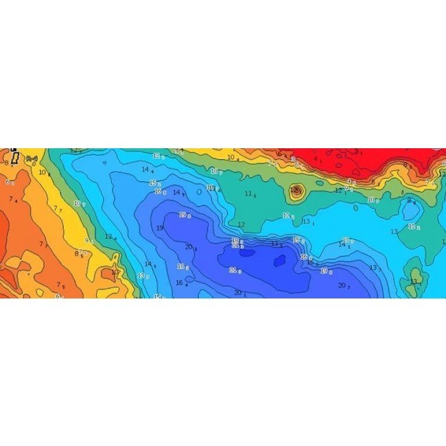
C-Map Discover Marine Charts give you a Range of features for your Combo units including vectors charts, bathymetry data and more all in high detail to suit any trip you may make.
- Vector charts make Navigation easy with an up to date view derived from official Hydrographic Office information
- A high-res >Bathymetric Data layer allows for easy spotting of shallow spots or points like drop offs, holes/humps down to 1ft level. Includes Genesis social mapping, quality controlled and integrated
- Custom depth shading allows you to se a safety level and keep a certain view going similar to a paper chart
- Easy Routing allows for simple automatic calculation of the shortest route based on your input data and vessel information
- Tides and currents shown as water level and direction projections
- Marina Port Plans with detailed information such as Slip spaces, restricted areas and more
- 12 months free updates by user
Specifications
Additional Information
| Brand | C-Map |
|---|---|
| Country of Manufacture | Unknown |
Reviews


