You have no items in your shopping cart.
How does AIS work?
AIS (Automatic Identification System) is an anti-collision system that identifies a vessel's position, Course, speed and identity through VHF digital information.
This helps to improve your situational awareness by identifying targets obscured by poor visibility, or hidden behind larger targets like low islands or large ships that >Radar can't penetrate.
There are two main classes of AIS – Class A and Class B – as well as different types of AIS used for shore stations (AIS Base Stations), >Aids To Navigation (AIS AtoN), AIS on search and rescue aircraft and AIS search and rescue transmitters (AIS SART).
Key AIS Data
Your ship's data, also known as >Static data, must be programmed into the AIS transceiver at the time of installation. This includes information such as:
Vessel name: The vessel’s name is transmitted – some AIS transmitters may take a while to send this, but you will always have the MMSI (see below) should you wish to call a vessel. AIS will also transmit what type of vessel yours is, as well as its dimensions.
MMSI: Maritime Mobile Service Identity – your vessel's unique nine-digit code. MMSI registration also includes contact information to be used in case of an emergency.
Call Sign: Your vessel’s unique call sign is assigned by the national authority and allows you to identify the Ship or craft, then call them if necessary.
Other useful terms
SOG: Speed over ground.
COG: Course over ground.
CPA: Closest Point of Approach – the closest that you will come to the vessel in question, should you both maintain your Current Course and speed.
TCPA: Time to >Closest Point of Approach – when the closest pass will occur.
Class A and Class B AIS
Class A AIS is mandated by the International Maritime Organisation (IMO) for:
• Vessels of 300 gross tonnage or more engaged on international voyages
• Cargo ships of 500 gross tonnage and upwards not engaged on international voyages
• Passenger ships (more than 12 passengers), irrespective of size.
Class B is for voluntary fits to power and sail boats alike. Class B AIS is intended for non-SOLAS vessels. It is not mandated by the International Maritime Organisation (IMO) and has been developed for vessels such as work craft and pleasure craft.
Key Features of AIS
Dangerous vessels
Highlight 'dangerous' vessels that potentially pose a threat to you. On B&G Zeus and Vulcan plotters, and Triton2 instruments, dangerous vessels will be displayed with a heavy outline.
To set this up, go into Settings and set >Closest Point of Approach (CPA) and Time to >Closest Point of Approach (TCPA).
Vessel Alarms
You can set alarms to warn you when an AIS target becomes a threat. This is especially handy in quieter waterways where boats are less likely to be around, ie. offshore, or crossing the Channel.
Simply go into Settings, then enable Alarms > Vessels > Dangerous vessels.
Extension Lines
Enable Extension Lines, so you'll have a >vector of a vessel's Course and Heading. You'll be able to see where you are, along with the location of any vessels around you, as well as a prediction of where you'll all be in the next 10 minutes. These extension lines also help to show relative speed, so you can easily identify a high-speed craft.
Last position report
Vessel icons will continue to be displayed even when the signal is lost for a preset period of time. If a target hasn’t moved for a while and you’re worried, you can check the ‘age’ or the time the signal was last received. A different icon (strike-through) appears when the signal has been lost.
Aids to Navigation (AtoNs)
AtoNs – such as buoys, drift nets etc fitted with AIS transmitters – give a useful real-time location of marks, which can be especially useful for location in strong tidal flows where they may be dragged down-tide. They have a different icon to vessels – a diamond with an 'x' inside.
Personal AIS
Personal AIS-enabled rescue beacons are becoming more popular to help crews locate a Man Overboard. These transmit an MMSI number with the prefix of 972 to identify them. Up-to-date chartplotters will display these correctly, but older ones may need a software update to correctly identify the signal and give you the option of initiating a >Man Overboard based on its position.
Clutter
As Class B AIS transmitters become more popular, the number of icons increases in busy waterways. If you’re struggling to make sense of your charts, you can filter the targets, for instance only displaying dangerous vessels. You can also 'hide all' if you don’t need AIS at the time. This must be used with care, but can be a useful Way to increase the visibility of the screen.
If you have a compatible VHF DSC radio on your network, such as the B&G V60 and V90S, you can initiate DSC calls to vessels with a single tap on the screen.
For more information on AIS and other technologies, get in touch with us here at CH Smith Marine on (03) 9403 4800.
Aids to Navigation (AtoNs)
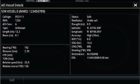
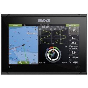
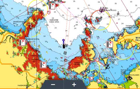
An example of AIS information displayed.
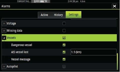
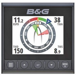
Set Vessel Alarms to warn you when an AIS target becomes a threat.
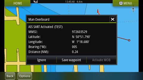
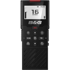
Personal AIS will transmit an MMSI number to help locate a man overboard.
Related Products
-
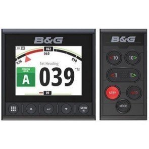
B&G Triton² Autopilot Controller & Display
RRP: $1,199.00
NOW: $1,105.00
-
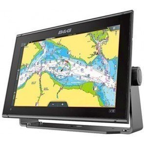
B&G Vulcan 12 FS GPS Chartplotter
-
B&G Vulcan 9 FS GPS Chartplotter
-
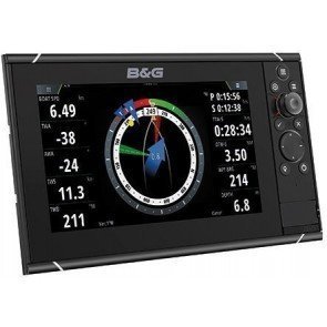
B&G Zeus3 12 Touch Multifunction Display
-
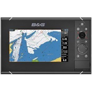
B&G Zeus3 7 Touch Multifunction Display
-

B&G Zeus3 9 Touch Multifunction Display (Discontinued)
-
B&G Triton2 Display
RRP: $769.00
NOW: $720.00
-
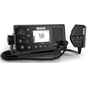
B&G V60 DSC VHF AIS Radio
RRP: $899.00
NOW: $841.50
-
B&G V60-B DSC GPS VHF AIS-B Radio
RRP: $1,599.00
NOW: $1,497.00
-
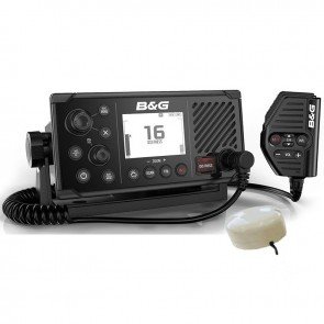
B&G V60-B DSC VHF AIS-B Radio with GPS-500 Antenna
RRP: $1,649.00
NOW: $1,543.50
-
B&G H50 VHF Wireless Remote with AIS Display (Discontinued)
-
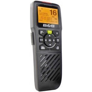
B&G H60 DSC Wireless Remote With AIS Display
RRP: $349.00
NOW: $322.00