You have no items in your shopping cart.
This product has been discontinued.


Product Description
Details
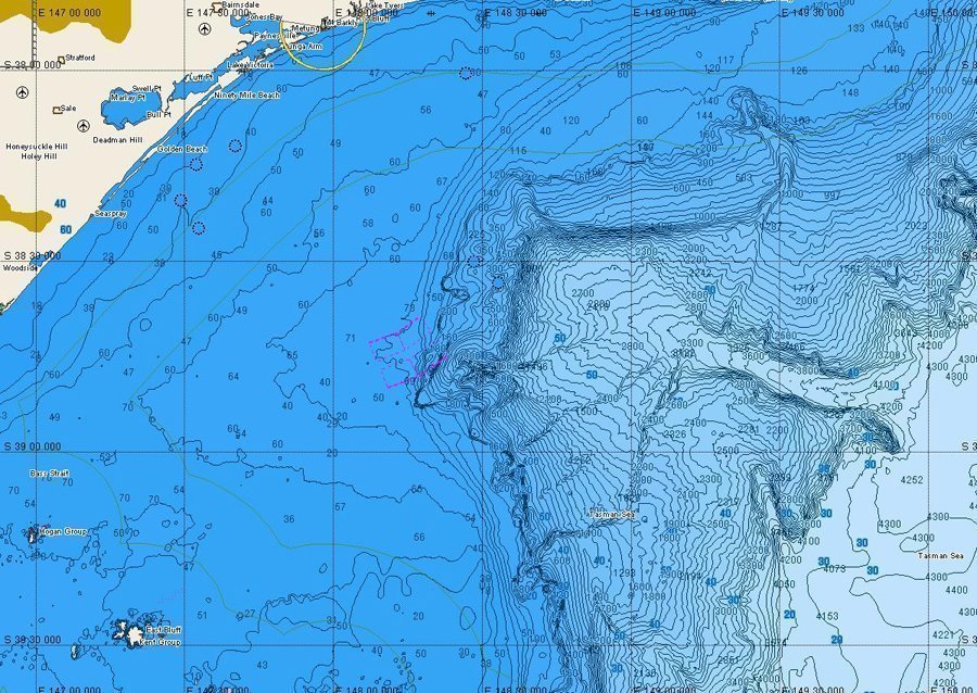
C-Map Bathymetric Charts will let you jump out of the Boat and experience the ocean's bottom from a fish's view thanks to their detail. C-MAP Bathymetric Charts are available in both NT+ and MAX formats on C Cards and SD Cards.
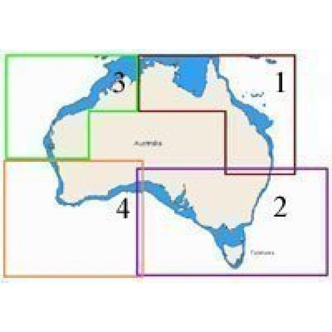
There is too much data to fit all of Australia on one card and they have their own unique coverage areas. The sailing fraternity will be able to use these charts to predict eddies in currents to improve performance while fishermen will be able to use them to find prominent seafloor structure to predict upwellings where the elusive bait Fish hides. Fishermen, mariners and sailors alike will find Jeppesen Bathymetric Charts a practical companion to standard navigational charts.
As an authorised programming depot, CH Smith Marine will upgrade your old CMAP data to the latest release while you wait!
- Rich high Resolution details – from depths 20 metres and below – make them ideal for fishermen, divers, mariners and sailors alike.
- Sold as separate cards and cannot be combined onto one card with the existing map data
- Jeppesen Bathymetric Charts are not intended for navigational use.
- View a List of the CMAP Charts for Chart coverage
- To see if C-MAP is compatible with your plotter, check the CMAP Compatibility Guide
Specifications
Additional Information
| Brand | C-Map |
|---|
Reviews


