You have no items in your shopping cart.
How to display SonarChart on your plotter
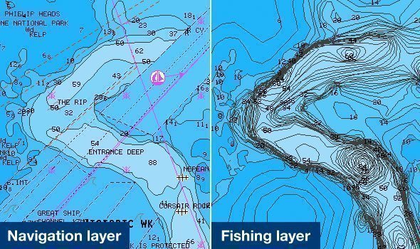
One of the perks of pairing a Navionics map with your chartplotter is having access to SonarChart's Bathymetric Charts, adding high definition 0.5m bottom detail to your maps.
SonarChart appears as an additional layer over your map to display this information.
Here's how to find it on your plotter:
Humminbird
Press the Menu button twice, then go to the Chart tab and then down to Chart Select. Then select SonarChart (or FishN'Chip on older models.
Lowrance, Simrad or B&G
Press Menu, Chart Options, then scroll down to View and select FishN'Chip.
Raymarine
Press Menu, Presentation, Chart Selection, then SonarChart.
Note: Instructions may vary depending on model.