You have no items in your shopping cart.
Navionics Platinum - How to access Relief Shading
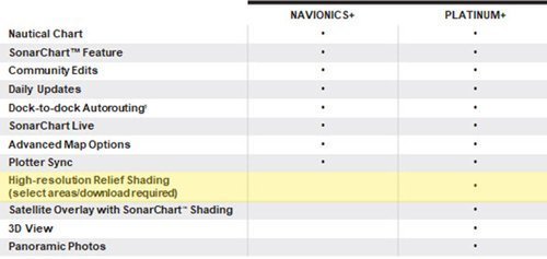
You can now access high-resolution Relief Shading through your Navionics Platinum+ charts, working in conjunction with SonarChart to bring bottom detail to life.
Relief Shading is created from multibeam surveys and high-definition data to show intricate bottom detail of channels, offshore shelves, artificial reefs, wrecks and sandbars, so you can understand your surroundings at a glance and easily identify fish-holding structure.
With Platinum+, you can now also access updated SonarChart Shading – an overlay which combines satellite imagery with detailed renderings of bottom structure, based on SonarChart 1-foot bathymetry data.
Relief Shading is included with your active Navionics subscription, along with all existing Navionics features like Community Edits and Dock-to-dock Auto-Routing.
You can access it by downloading Relief Shading to your Platinum+ map.
Please note: Navionics+ and Platinum+ Chart cards cannot be used with Garmin devices. Garmin hardware owners may purchase Bluechart g3 and Bluechart g3 Vision, which include Navionics data. Further details here.
For tips and other advice on all things fishfinders and sounders, give us a call at CH Smith Marine on (03) 9403 4800.
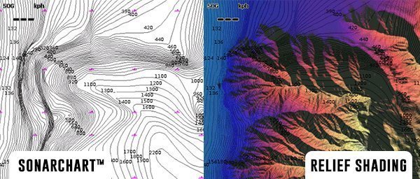
Relief Shading works in conjunction with SonarChart to bring bottom detail to life.
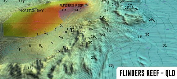
Relief Shading around Moreton Bay and Flinders Reef, QLD.
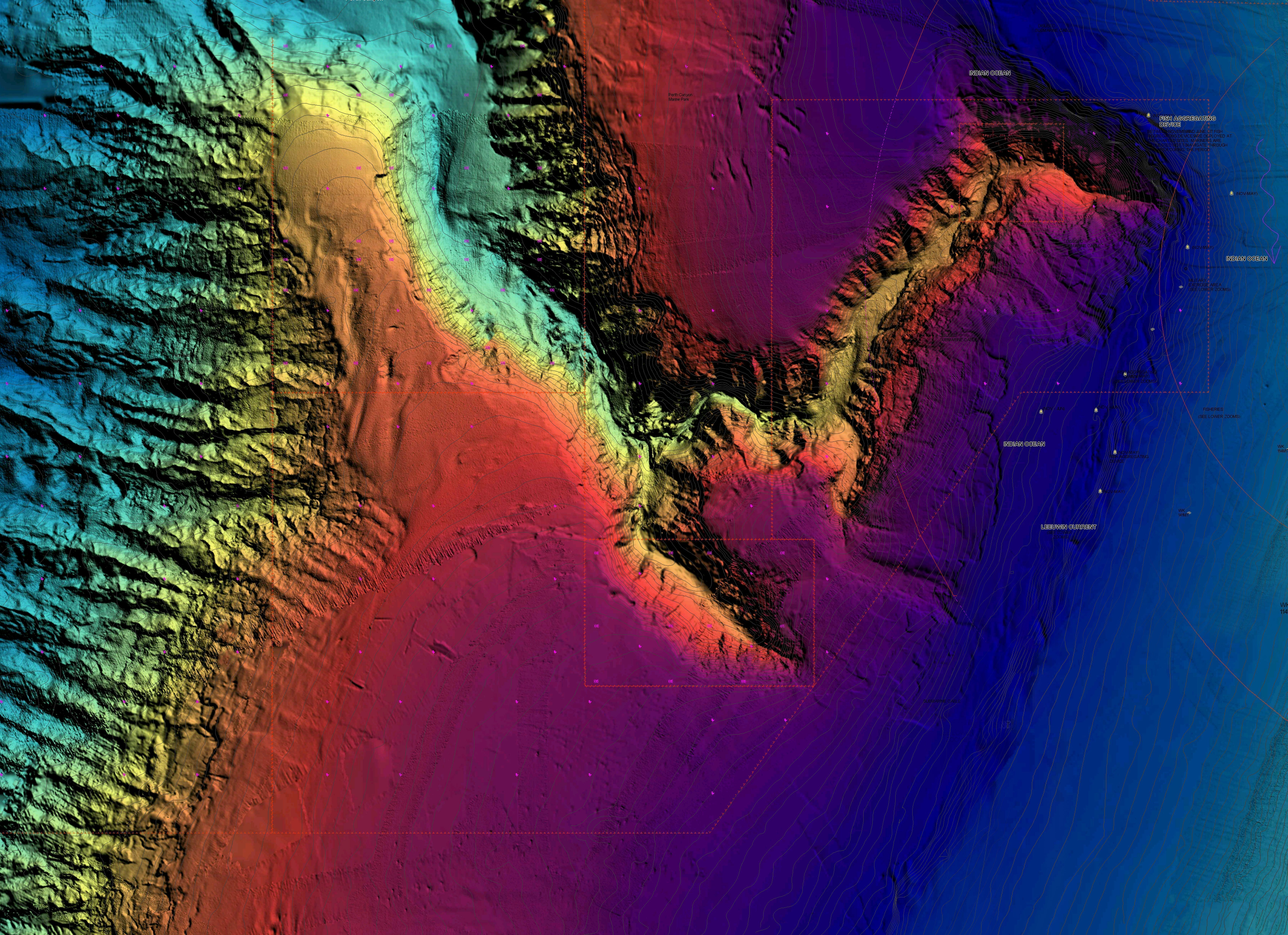
Relief Shading around Perth Canyon.