You have no items in your shopping cart.
Humminbird AutoChart and AutoChart Pro
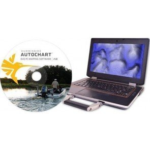
Humminbird Autochart Software can leave no waters uncharted. AutoChart Zero Line SD Card gives you access to the zero lines for numerous bodies of water where you fish—the starting point for creating accurate, detailed maps of any uncharted waters. The Zero Line is the place where the water meets the shore. Humminbird AutoChart includes a map card loaded with Zero Lines for millions of water bodies. With these all-important Zero Lines as your foundation, you can begin creating your own accurate and detailed maps of any fishing spot. The Zero Line map card is also formatted to record your Sonar logs.
After recording, load the card into your computer to let the AutoChart PC Software convert the recordings into a map that can be displayed on your compatible Humminbird. AutoChart’s proprietary software uses your compatible Humminbird’s Sonar returns and GPS to automatically build your charts. No subscriptions or hidden fees. No need to submit your data and wait for a finished Chart. AutoChart does it in just three simple steps—and your data is kept private, so your competition is none the wiser.
3 Easy Steps
- Record your survey data: Travel back and forth then up and down water in a zig-zag pattern with your compatible Humminbird in record mode.
- Convert your data: Transfer the saved survey data from your Humminbird to your PC via the AutoChart Zero Lines map card (included). AutoChart will convert that data into a detailed map.
- Export your map: Save the newly created map back onto your AutoChart Zero Lines map card for use in your Humminbird.
AutoChart
- Humminbird combos with SD Card slot & software V6.9 or later is supported by Autochart.
- Zeroline card can be used on any unit and it is not unique to one unit. To share your information with another Boat they must have a zeroline card.
AutoChart PRO
Add another layer of detail to your AutoChart Cartography. New AutoChart PRO offers all the leading features of AutoChart - but with two key enhancements designed to give tournament anglers a competitive edge.
- Bottom Hardness Indication delivers a crucial tip-off to where Fish are hiding
- Side Imaging Mosaic allows you to overlay your Side Imaging returns onto your AutoChart map for a 3D visualization of fish-holding habitat. With AutoChart PRO, you'll have all the tools necessary to bring your next trophy in sight.
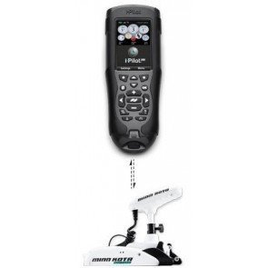
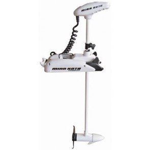
With i-Pilot Link's innovative 'Follow the Contour' feature, it directs the Trolling motor to follow a specific depth contour. The chosen contour Line can be automatically followed in either direction, or Stay a set distance from it or the shoreline using the Contour Offset feature. This incredible feature is now available on what was once previously unmapped water- when data is surveyed and converted using AutoChart.
When viewing your AutoChart maps on your PC you will be able to see the underwater world in amazing 3D detail, with other features including water level offset, highlight depth, mark Waypoints and more.
For more information on the new AutoChart Software, contact CH Smith Marine in store or online.
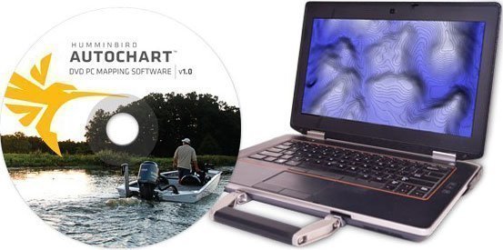
Autochart PC Software
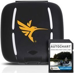
AutoChart™ Zero Line SD card (included with Autochart & Autochart Pro software)
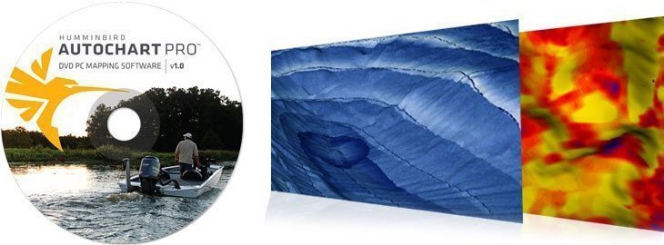
Autochart pro adds Bottom Hardness and Side Imaging Mosaic
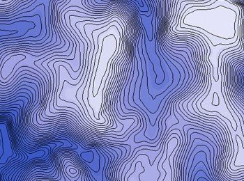
AutoChart generated contours